Lake News Alerts
We'd like to send you lake news articles, videos, and podcasts from around the web.
 We will never share your email
|
Lakes in Arkansas, United States
MAJOR LAKES
|
|
|
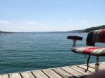
Beaver Lake is a man-made reservoir in the Ozark Mountains of Northwest Arkansas and is formed by a dam across the White River. Beaver Lake has some 487 miles of natural shoreline. With towering limestone bluffs, natural caves, and a wide variety of trees and flowering shrubs, it is a popular tourist destination. Beaver Lake is the source of drinki...
|
|
|
|
Bull Shoals Lake offers diverse wildlife species, varied fisheries, open waters for sailing and boating, picnic shelters and swimming areas, boat ramps, and scuba opportunities. Visitors enjoy these and many other recreational opportunities. The reservoir lies in the beautiful Ozark Mountains of northern Arkansas and southern Missouri.
The woo...
|
|
|

|
Lake Conway is the largest man-made game and fish commission lake in the United States. Construction of the lake began in 1948, with its waters coming from the runoff of Stone Dam Creek, Gold Creek, Palarm Creek, Little Cypress Creek and Panther Creek. Its average depth is six feet, with a maximum depth of 18 feet. The lake is approximately eight m...
|
|
|
|
|
Lake Dardanelle is a major reservoir on the Arkansas River in Arkansas, USA. Russellville lies on Lake Dardanelle, and the lake provides many recreational opportunities. Lake Dardanelle covers nearly 40,000 acres of land, which provides lots of area for boating, fishing, picnicking, camping and scenic views. The lake extends from Dardanelle Loc...
|
|
|
|
|
DeGray Lake is a reservoir on the Caddo River, 8 miles (13 km) from Arkadelphia. DeGray Lake offers a huge span of recreational area and spectacular views. Arkansas Scenic Byway 7 is located on the eastern shore of the lake, and provides views of the lake, and also places to stay down the road.
DeGray lake and dam were authorized by Congress in t...
|
|
|
|
|
The Felsenthal Lock and Dam is part of the Ouachita River Basin, which is characterized by hilly wetlands and the 605-mile Ouachita River running through it. Local recreational activities include boating, camping, fishing, hunting, and hiking....
|
|
|
|
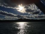
Greers Ferry Lake is the reservoir formed by Greers Ferry Dam, a United States Army Corps of Engineers dam in Northern Arkansas. It is located about 60 miles (100 km) north of Little Rock. It is often ranked as one of the top ten clearest, cleanest, and most pristine lakes in all of North America.
The reservoir consists of two lakes connected by a...
|
|
|
|
|
Lake Greeson is a reservoir on the Little Missouri River, about 6 miles north of Murfreesboro, Arkansas. Famous for its scenery and recreation, it is surrounded by 15 parks that offer opportunities for camping, fishing, boating, biking, and swimming.
The lake is created by Narrows Dam, named after the area in which it is located, "The Narrows". La...


Full Pool: 548.0 MSL
Area: 7,200 Acres
|
|
|
|
|
Lake Hamilton was created in 1932 when the Arkansas Power and Light Co. completed Carpenter Dam on the Ouachita River to generate electricity. Today, the 7,460-acre impoundment is one of Arkansas's most popular recreational and residential lakes. Much of it is ringed with condominiums, resorts, motels, restaurants and private homes. State Scenic 7 ...
|
|
|
|
|
Central Arkansas's main water supply, Lake Maumelle has an area of 8,900 acres covering an area of 14 square miles and a 70-mile shoreline. No swimming is allowed but boating and fishing are popular pursuits. The lake is well-known for the many sailing regattas it hosts and is used extensively by weekend skippers as well....
|
|
|
|
|
Millwood Lake is a reservoir in southwestern Arkansas, United States. It is located 9 miles from Ashdown. The lake is formed from the damming of the point where the Little River and the Saline River meet.
Lake Millwood is mainly recognized for its beauty and fishing. There are 15 recreational parks around the lake to provide campers with picnic ...
|
|
|
|
In the late 1930's, before construction of the Norfork Dam had begun, the local economy of Baxter County, Arkansas was deteriorating. The yearly per capita income had fallen to between one-hundred and two-hundred dollars, and in 1940 alone more than six hundred small farms were abandoned. Those who remained looked forward with enthusiasm to any sol...
|
|
|
|
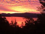
Lake Ouachita (Pronounced WAH-shi-tah) is a reservoir created by the damming of the Ouachita River by Blakely Mountain Dam.
The Downstream side of Blakely Mountain Dam as photographed from the river in July 25, 2009
Blakely Mountain Dam was built by the United States Army Corps of Engineers from 1948 to 1953 for hydroelectric power, recreatio...
|
|
|
|
|
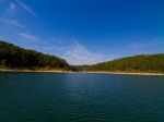
Ozark Lake is a major unit in the multiple-purpose plan of development of the Arkansas River and tributaries, known as the McClellan-Kerr Arkansas River Navigation System. Ozark Lake covers 10,600 acres of water area and a land area of 6,349 acres surrounds the lake and extends around the shoreline for a distance of 173 miles. The lake is situated ...
|
|
|
|
OTHER LAKES IN ARKANSAS
(alphabetical)
|
|
Lake Name
|
Full Pool *
(MSL) **
|
Acres
|
River
|
Map
|
|
Atalanta
|
|
30
|
|
|
|
Austell
|
|
66
|
|
|
|
Bailey
|
|
|
|
|
|
Bald Knob
|
|
154
|
|
|
|
Bear Creek
|
|
625
|
|
|
|
Beaverfork
|
|
960
|
|
|
|
Bennett
|
|
33
|
|
|
|
Big
|
|
|
|
|
|
Blue Mountain
|
384.0
|
2,910
|
|
|
|
Brock Creek
|
|
|
|
|
|
Cane Creek
|
|
1,675
|
|
|
|
Catherine
|
|
|
Ouachita River
|
|
|
Charles
|
|
645
|
|
|
|
Chicot
|
|
|
|
|
|
Columbia
|
|
3,000
|
|
|
|
Cove
|
|
160
|
|
|
|
Craighead Forest
|
|
60
|
|
|
|
Crown
|
|
645
|
|
|
|
DeQueen
|
437.0
|
1,700
|
|
|
|
DeSoto
|
|
200
|
|
|
|
Dierks
|
526.0
|
1,360
|
|
|
|
Dunn
|
|
68
|
|
|
|
Erling
|
|
2,350
|
|
|
|
Fayetteville
|
|
230
|
|
|
|
Fort Smith
|
|
260
|
|
|
|
Frierson
|
|
335
|
|
|
|
Georgetown
|
|
|
|
|
|
Georgia Pacific
|
|
1,800
|
|
|
|
Gillham
|
502.0
|
1,300
|
|
|
|
Harris Brake
|
|
1,240
|
|
|
|
Hinkle
|
|
960
|
|
|
|
Horseshoe
|
|
|
|
|
|
Island Forty Chute
|
|
|
|
|
|
Leatherwood
|
|
85
|
|
|
|
Magness
|
|
|
|
|
|
Mallard
|
|
|
|
|
|
Mirror
|
|
|
|
|
|
Monticello
|
|
1,402
|
|
|
|
Moro Bay
|
|
|
|
|
|
Nimrod
|
342.0
|
|
|
|
|
Omaha
|
|
139
|
|
|
|
Peckerwood
|
|
|
|
|
|
Poinsett
|
|
640
|
|
|
|
Shady
|
|
|
|
|
|
Shores
|
|
|
|
|
|
Spring
|
|
|
|
|
|
Storm Creek
|
|
425
|
|
|
|
Sylvia
|
|
|
|
|
|
Walcott
|
|
31
|
|
|
|
Wapanocca
|
|
600
|
|
|
|
Wedington
|
|
102
|
|
|
|
White Oak
|
|
|
|
|
|
Windsor
|
|
220
|
|
|
|
Winona
|
|
1,280
|
|
|
|
Winthrop Rockefeller
|
|
|
|
|
* Full Pool - Highest normal summer pool level before flood stage
** MSL - Mean (average) feet above sea level
|
|